Looking East from Lifford late 1880s (approx 200 yards SW of Lifford bridge) | fullsize Image supplied by Mr Curlyhill. The original metal sign can be found at the UAFP.
1894: 13-16 July: The Finn Valley/Donegal Railway line converts to 3'0" narrow gauge.
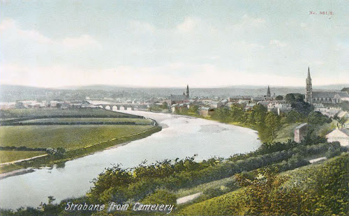
Anew railway bridgeconstructed over the River Mourne opens. (see Donegal section)
For a more accurate location see the Photo History Map, or load the BlogPhoto.KML file into Google Earth.
Quote: Mr Curlyhill
My deduction of this is that it was a promotional item issued by a Wine and Spirit Merchant called Sproule and McIvor. They were in existence in 1882 but no Longer in the 1890s.
The last recorded name of Sproule & McIvor was between 1891 and 1892, thereafter it became solely McIvor. This is my deduction of the drawing being done in the late 1880s.
Building locations: extrudes from the 1905 ordnance survey in Google Earth. Strabane Bridge is represented by the horizontal box at the bottom of F,G and H.
It is possible that the large building on the extreme right edge of the Sproule and McIvor poster, (also shown as the marker labeled 'H' in the Building locations 3D reconstruction), is the tower at Saint John's Church. Saint John's was built in 1827 on the current site of Strabane Grotto. A tower was added to the church in the year 1837. (See related document: Christianity and Catholicism in Strabane before 1895)
Narrator: Sister Ursula (Convent of Mercy)
Audio Source: Mr Curlyhill
Song Lyrics: Willliam Collins
Closed captioning is available at Youtube.com.
The lyrics to the song "At the foot of Knockavoe" were written by William Collins. Collins was born in Strabane in 1840 and emigrated to Canada at the age of 15. Later he moved to Cleveland and enlisted in the Federal Army. He fought in both the American Civil War, and in the Fenian Raid of Canada. After the wars, he wrote several books of poems. Collins also wrote for the Boston Globe and the New York Globe.
In recent times, the words from Collins's poem "At the foot of Knockavoe" were put to music by Strabane man and local musician, Joseph Gormley.
Here is the download link to the Battle of Knockavoe points-of-interest file. To use: Open the file inside Google Earth.
Knockavoe battle analysis by Mr Curlyhill | click image for fullsize Related links:
Strabane District Council - William Collins
Death notice of Sr Ursula Mc Hugh Dec-20-2010


